

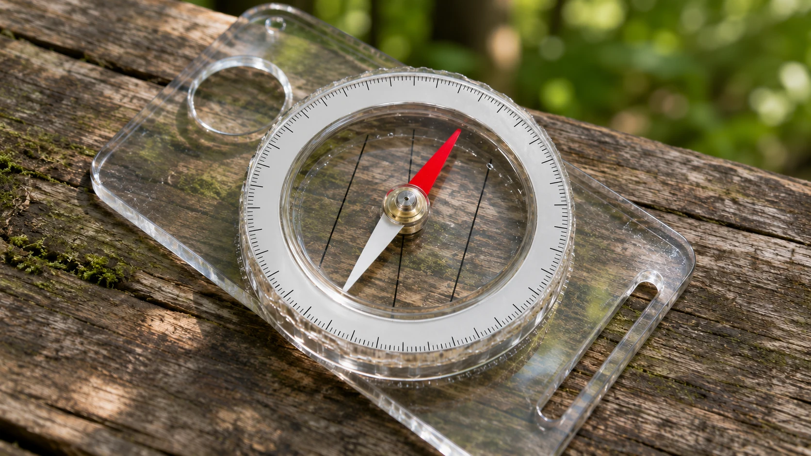
A small magnet responds to the field where you are standing
Place a compass on a level surface and turn its housing. The needle tends to keep a preferred direction while the markings move around it. That simple observation captures the instrument’s strength: it supplies a direction reference without needing to know your name, destination or coordinates.
It also exposes its limitation. A compass senses the field around it. If that field is distorted, or if you misunderstand the kind of north being indicated, a confident-looking needle can still lead to a mistaken interpretation.
The needle is a small magnet
A magnetic compass contains a magnetized element free to turn. The surrounding magnetic field exerts a torque, tending to align that element with the field. A conventional horizontal compass responds to the field’s horizontal direction.
The U.S. Geological Survey’s explanation emphasizes that the compass follows the local magnetic field. It also notes that local electrical systems and magnetized rocks can affect the preferred direction. [1]
“Points north” is useful everyday shorthand. The more precise statement is that the needle responds to a physical condition at its present location. It is not sending a signal to the Arctic or receiving a message from a pole.
If the mechanism is unfamiliar, start with how magnets work. The compass adds a freely rotating reference to the interaction between a magnet and a field.
Where does Earth’s field come from?
Most of Earth’s large-scale magnetic field originates in the core. Motion of electrically conducting fluid in the outer core and the currents associated with that motion sustain a geodynamo.
The USGS introduction to geomagnetism describes this as a self-sustaining dynamo, with additional magnetic contributions from other regions of Earth and nearby space. The resulting field is more complicated than a perfect bar magnet drawn inside a globe. [2]
The bar-magnet picture can still be a first sketch of a broadly dipolar field. Its limit is just as useful to remember: a sketch with two tidy poles cannot reproduce every local direction or every change through time.
Imagine a map of winds. A broad circulation pattern can organize what you see without determining the precise wind at every street corner. Earth’s magnetic field is not wind, but the comparison helps separate a large-scale pattern from a local measurement.
True north and magnetic north answer different questions
True north is the direction along Earth’s surface towards the geographic North Pole, defined by the planet’s rotation axis. Magnetic north on a compass refers to the horizontal magnetic-field direction at the instrument.
The angle between those directions is magnetic declination. NOAA’s explanation makes an important correction to a common story: a compass aligns with the local horizontal field, not with a straight line drawn towards one universal magnetic point. [3]
This is why a map and compass need a shared reference. A bearing measured relative to true north and one measured relative to magnetic north are different descriptions unless declination happens to be zero at that place and time.
There is no contradiction in an instrument being accurate while its reading differs from the top of a map. Accuracy concerns what it measures. Interpretation concerns whether you use the correct reference.
Why following the needle is not a direct route to the magnetic pole
Natural Resources Canada explains that magnetic-field lines are not simple straight routes to the North Magnetic Pole. Following successive compass directions would follow changing local conditions rather than the shortest route to a single target. [4]
That distinction is easy to miss because a printed arrow looks like it is pointing at something. The arrow on a compass is better understood as a local orientation indicator.
Imagine taking a series of short steps while always following a locally measured direction. If that direction changes across the landscape, the route bends. The fact that each step follows the instrument does not make the overall path a straight line or the shortest possible journey.
| Term | Meaning | Useful question |
|---|---|---|
| True north | Direction towards the geographic North Pole | What reference does the map or bearing use? |
| Magnetic north | Horizontal magnetic-field direction here | Which way does the magnetic instrument align? |
| Declination | Angle between magnetic and true north | How do the two direction references differ? |
| Inclination | Angle of the field above or below the horizontal | How steeply does the field tilt? |
Declination is not the same as magnetic dip
Earth’s field has a three-dimensional direction. Declination describes its horizontal orientation relative to true north. Inclination, also called dip, describes its angle relative to the horizontal plane.
NOAA’s field-calculator documentation treats these as separate components. A simple compass dial mainly gives a horizontal direction; it does not display the entire three-dimensional field vector. [5]
A useful comparison is describing a ramp. “It faces east” and “it slopes down by ten degrees” provide different parts of the description. One direction alone does not tell you the slope.
Keeping the terms separate also prevents an incorrect explanation of a tilted or dragging needle. The field’s downward component and the instrument’s mechanical arrangement are different from the east-or-west declination correction used with a map.
What happens near a magnetic pole?
Near a magnetic pole, the field becomes steeply inclined and its horizontal component weakens. The part that ordinarily gives a horizontal compass its directional preference can become too small for reliable use.
Natural Resources Canada’s guidance on using a compass explains that the horizontal force decreases towards the North Magnetic Pole and is zero at the pole itself. The instrument’s familiar behaviour at lower latitudes should not be assumed to continue unchanged. [6]
This is another reason the “needle is pulled straight towards the pole” picture fails. At the pole, the defining magnetic direction is vertical, not a strong horizontal arrow showing you which way to walk.
Why do declination values change?
The field evolves. A declination value therefore belongs to a location and a date, rather than to a city forever. Changes in the large-scale field are one reason magnetic models need regular updates.
NOAA and the British Geological Survey jointly produce the World Magnetic Model. The current model series covers 2025–2030; it represents the main field and its expected change, rather than every nearby source of magnetic disturbance. [7]
A historical map can still contain valuable geographic information while its printed magnetic information needs checking. The age of the declination note matters even if the roads and rivers have not visibly changed.
For a much longer timescale, explore how Earth’s magnetic field reverses. A modest change in a local bearing is not, by itself, evidence that a global reversal is happening.
A simple example of two reference directions
Suppose an imaginary location has a declination of 10° east. Magnetic north there lies ten degrees clockwise from true north. A line pointing exactly along magnetic north is therefore not a true-north line.
NOAA’s calculator guidance uses signed east and west angles to express this relationship. The example is hypothetical; it is not a declination value for your current location. [5]
The practical lesson is to label the reference before comparing numbers. “Ten degrees” without a sign, location, date or definition is an incomplete piece of navigation information.
It is also wise to avoid memorizing a single correction slogan without understanding the compass and map involved. Adjustable instruments and software can already apply corrections. Applying the same adjustment twice produces a new error.
Why can the needle move near a phone, vehicle or metal structure?
A compass responds to the total local field, not only to the part generated deep inside Earth. Nearby magnetic material, electrical equipment or magnetized rock can change the reading.
USGS guidance identifies local interference as a real limitation of the measurement. A compass that turns near an interfering source may be responding correctly to the altered field while giving a poor indication of the undisturbed geomagnetic direction. [1]
A modest indoor observation can make the point without planning a journey. Hold a compass level away from obvious nearby magnetic objects, note its resting direction, and compare that with a reading close to a small ordinary magnet. Move the magnet away and watch whether the original direction returns. The observation demonstrates sensitivity to the field; it does not calibrate the instrument.
Why a GPS direction is not automatically the same thing
A device can report bearings using different north references. USGS guidance on GPS and compass settings emphasizes keeping those references consistent, including whether a compass has an adjustable declination correction. [8]
A number on a screen should therefore be read with its label and settings. Two instruments can show different bearings because they use different references, rather than because one of them has mysteriously stopped working.
The general lesson extends beyond navigation: compare like with like. A magnetic heading, a true bearing and a map-grid bearing are descriptions with different reference frames. The measurement is not complete until the reference is known.
Frequently asked questions
Does a compass always point exactly to geographic north?
No. It aligns with the local horizontal magnetic field. Declination describes the difference from true north, and disturbances can introduce further changes. [3]
Does a compass need a battery?
A conventional magnetic needle does not need electrical power to align with a field. Electronic instruments and illuminated or connected devices may have their own power requirements.
Is the magnetic pole a fixed destination?
No. Earth’s field changes, and magnetic models must account for that evolution. A compass reading is still a local measurement, not a direct position fix for a moving pole. [7]
Can a compass tell me where I am?
By itself, it provides a direction reference rather than a position. Knowing which way is magnetic north does not establish your coordinates, destination or a safe route between them.
Keep exploring
Sources and further reading
Reference review: November 7, 2026. Abstract-only sources are labelled in the references.
- U.S. Geological Survey — How does a compass work?
- U.S. Geological Survey — Introduction to Geomagnetism
- NOAA NCEI — Magnetic Declination
- Natural Resources Canada — Magnetic declination
- NOAA NCEI — Magnetic Field Calculator Help
- Natural Resources Canada — Using a compass
- NOAA NCEI — World Magnetic Model
- U.S. Geological Survey — How Should I Set My GPS and Compass?
Keep exploring.
One remarkable idea at a time—nature, science, history and beyond.
Last updated November 8, 2026.

Barnakle Editorial Team
Barnakle Editorial Team is the collective byline used for Barnakle’s editorial articles. The contributor profile explains the team identity and links to the publication’s editorial policies.
More from the editorial team →