
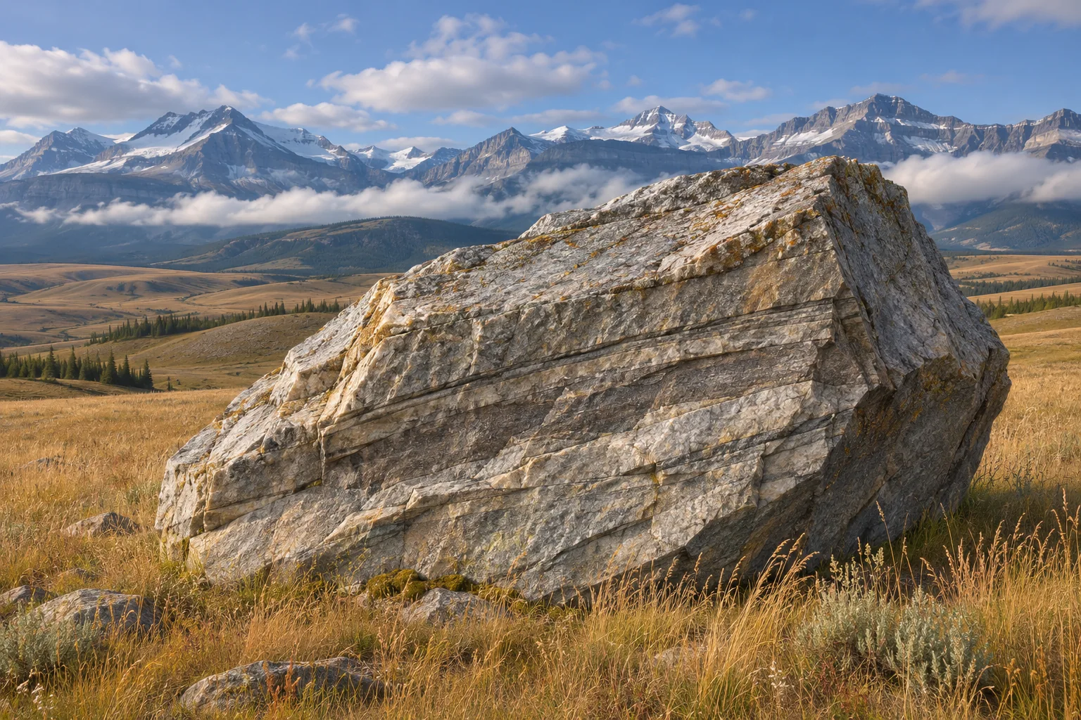
West of Okotoks, Alberta, a split block of quartzite rises above the prairie. The provincial estimate puts its mass at about 16,500 tonnes. Its size makes it easy to notice, but a geologist’s most revealing question concerns its address. Rock like this belongs to a mountain formation in the Jasper region. How did a piece of that formation come to rest so far from its neighbours?[2]
A glacier can pick up broken rock, carry it across a landscape and leave it behind when the ice melts. A stone delivered this way is called a glacial erratic. Some ride on top of the ice after a rockfall. Others travel within the glacier or close to its bed. A block can remain after nearly every visible trace of its carrier has disappeared. The evidence of that journey lies in the block itself and in where similar blocks turn up.[1, 2]
How a boulder boards a glacier
Stand in imagination at the bottom of a steep mountain wall. Rock falls from the wall and comes to rest on the valley floor. In an ice-free valley the trip might end almost as soon as it began. Fill that valley with moving ice and the same fall puts the rock on a slow conveyor. The impact supplies only the first, short part of the journey. The glacier supplies the long-distance transport.[2]
A different route begins at the glacier bed. Ice can pluck pieces from fractured bedrock and incorporate them into its moving load. Position makes a difference. A fragment pressed against other rock at the base may experience abrasion along the way. A block that spends much of its trip high on the ice can retain sharp edges or recognizable bedding. Shape offers clues, but a jagged edge alone cannot tell a geologist where the stone came from.[1]
Imagine finding two blocks with the same angular outline. One lies beneath a cliff of matching rock. The other sits on an open plain where the bedrock is quite different. In the first case gravity offers a short, local explanation. In the second, attention turns to a more distant source. Even then the rock type, the deposits nearby and the evidence of ice across the region all matter. Calling something an erratic is an account of transport, not a measurement of how big it looks.[1, 5]
Following a distinctive rock back to the mountains
A rock type can work like a return address when it has a distinctive combination of minerals, grain size, colour and internal layers. Geologists compare those features with exposed formations shown on geological maps. A possible match marks a candidate source. If the same kind of rock crops out in several places, one isolated block may be compatible with several different journeys.[1]
Now add the locations of twenty matching blocks. A long, narrow distribution leading away from one candidate source can help distinguish it from the others. Gaps in the distribution need interpretation. Some stones may be buried, some removed, and some simply hidden from the survey. A map of recorded finds samples the route. It rarely shows every place where passing ice carried that rock.[3]
That is the value of Alberta’s Foothills Erratics Train. Here “train” means a trail of related material. The Alberta Geological Survey makes mapped occurrences available as point data. A dot represents a recorded occurrence. It does not tell us the precise road one particular boulder took between two dots. Read the points together with the bedrock map and the reconstructed positions of the ice masses, and a coherent transport direction emerges.[3, 4]
The route to Big Rock
The provincial account traces the debris that included the Okotoks block to a rockslide onto ice in the Athabasca valley. The ice carried the debris out of the mountains. Along the foothills, mountain ice encountered ice moving from the interior of the continent. The distribution of quartzite erratics helps researchers reconstruct a southward route along that meeting zone. Blocks now scattered across the landscape were once passengers on ice.[2, 3, 4]
Picture marking one parcel of moving ice with a flag. The mountain front can steer that parcel in one direction, and contact with another mass of ice can turn it away from the path a modern stream would follow. Looking up the nearest river from a deposited boulder may point toward the wrong valley. The relevant landscape includes the shape and thickness of ice that no longer exists.[1, 4]
Today Big Rock also has longstanding spiritual significance to Blackfoot peoples. The Government of Alberta describes protected pictographs and asks visitors to stay off the rock surfaces. The geological story explains where the stone originated. Its continuing significance at the place where it came to rest is part of the history of that specific landmark.[2]
What an erratic can reveal about vanished ice
In Yosemite, the US National Park Service describes erratics whose source lay east of Tioga Pass, across the present watershed divide. The match means glacier ice once carried material over the pass. If you drew the route using only today’s drainage arrows, that trip would look as though it went the wrong way. A sufficiently thick glacier can flow in response to the slope of its ice surface even where the underlying bed rises locally.[1]
At a very different scale, the American Museum of Natural History’s guide to Central Park describes an erratic resting on Manhattan Schist. There the comparison can begin within a few footsteps. Look at the stone and the bedrock beneath it as two separate specimens. Their contact records the final resting place of the upper rock. It need not mark the place where the two rocks formed together.[5]
One last distinction is easy to miss on a map. The distance measured in a straight line from a known source to a deposited block gives a minimum journey. A route around bends in a valley or along the margin between ice masses can be longer. A destination, a likely source and a plausible route are three separate discoveries. A lone boulder raises the question. Finding its relatives across an entire region is what makes the answer persuasive.
Keep exploring
Follow the movement of glacier ice, then look at the hollows left where isolated blocks of ice melted.
Sources and further reading
- US National Park Service — Glacial Erratics
- Government of Alberta — Okotoks Erratic, Big Rock
- Alberta Geological Survey — Foothills Erratics Train, Southwestern Alberta
- Alberta Register of Historic Places — Hetherington Erratics Field
- American Museum of Natural History — Field Guide for the Geology of Central Park and New York City
Keep exploring.
One remarkable idea at a time—nature, science, history and beyond.
Last updated November 19, 2026.

Barnakle Editorial Team
Barnakle Editorial Team is the collective byline used for Barnakle’s editorial articles. The contributor profile explains the team identity and links to the publication’s editorial policies.
More from the editorial team →