
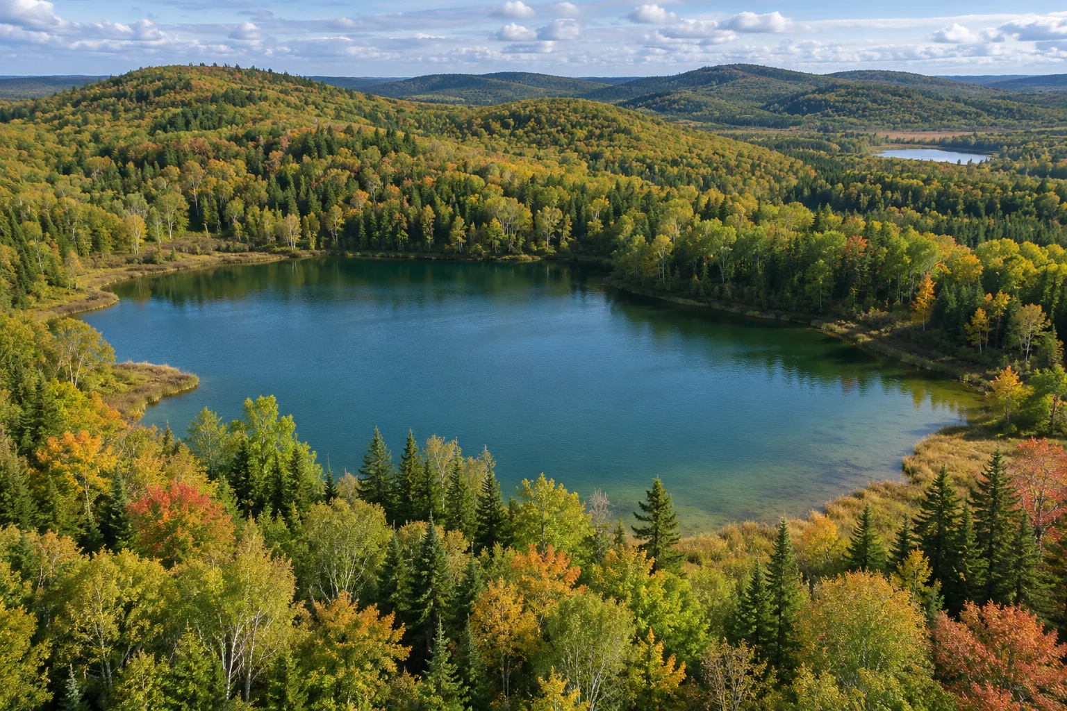
A kettle lake forms when a buried or partly buried mass of glacial ice melts, leaving a depression that fills with water. Sediment that had rested above or beside the ice settles into the space as that support disappears. The hollow is a kettle; it becomes a lake or pond only where water persists. [1, 2]
The main glacier may already have retreated from the area. A detached, stagnant block can remain behind under a blanket of sediment, preserving a pocket of ice while the surrounding landscape changes. Its eventual disappearance can therefore reshape ground that no longer looks like an active glacier margin. [3, 4]
How does a block of ice become buried?
Meltwater leaving a glacier carries sediment. When flowing water deposits that material beyond the ice margin, it can build an outwash plain. Pieces of ice left along the retreating margin may become surrounded or covered as sediment continues to accumulate. [1]
The National Park Service's account at Grand Teton describes blocks breaking from an ice-age glacier and becoming buried by meltwater sediment on the valley floor. The essential relationship is the same whether the eventual hollow is conspicuous or relatively modest: sediment occupies a landscape that still contains hidden ice. [7]
Burial can be incomplete. A block does not need a perfectly even covering, nor does every glacial deposit conceal ice. The later depression depends on a particular combination of ice, sediment and their changing relationship during melt-out. [1, 5]
Why does the buried ice last?
A sediment covering can insulate ice from the conditions melting the exposed glacier. Ontario Parks explains that buried blocks in the Kettle Lakes area melted slowly after surrounding streams had deposited material around them. The covering delayed the landscape's final adjustment to the disappearance of ice. [2]
The Turtle Mountains provide a regional example. NASA's geological account describes stalled glaciers buried under debris, with the covering delaying melt-out long after nearby uncovered ice had vanished. Those dates and durations belong to that region's history, rather than setting a universal timetable for kettle formation. [3]
North Dakota Geological Survey describes the resulting terrain as dead-ice moraine. In that setting, irregular sediment cover and stagnant ice produced a landscape that changed as hidden ice finally melted. What survived was a pattern of hills and hollows rather than a smooth impression of the original glacier. [4]
What happens as the ice melts away?
The buried ice occupies space and supports surrounding material. As it disappears, sediment can slump and settle. The resulting surface depression records both the lost ice and the movement of the sediment above and beside it. It is not necessarily a perfectly preserved mold of one block. [3, 5]
That distinction helps explain why kettle shapes vary. Researchers investigating kettle morphology have used ice and sand in laboratory experiments to explore how burial depth and ice volume influence the final depression. The experiments isolate relationships that are difficult to watch beneath a natural sediment cover. [5]
A laboratory kettle is a model of selected processes, not a miniature copy of every real basin. Natural deposits differ in grain size, structure, water content and history. The researchers' broader question is how formation conditions influence geometry, rather than whether all kettles should have the same outline. [5]
Does every kettle become a lake?
No. Ontario Parks notes that some kettles lie above the water table and remain dry or hold water only seasonally. A depression and a permanent body of water are different things. The first provides a basin; the second requires a water balance that maintains water within it. [2]
The Grand Teton example is useful because the landform can be appreciated as a depression within a glacial landscape. Its origin is tied to buried ice rather than to the presence of open water today. A kettle does not stop being a kettle simply because its present surface is dry. [7]
Conversely, water filling a rounded depression does not automatically establish a kettle origin. The surrounding sediments and glacial setting help distinguish the history of a basin. The same broad-looking shape can arise through different processes, so appearance is a clue to investigate rather than a complete diagnosis. [5, 6]
Where does the lake's present water come from?
The present water need not be original ice melt. Ontario Parks explains that rain, snowmelt and groundwater have long since replaced the old meltwater in its kettle lakes. [2]
A 2018 study of perialpine kettles combined geophysical, topographic and sediment information to investigate the basins and their later development. Its findings emphasize the importance of underlying materials for whether water can persist, linking the basin's geometry with the deposits below it. [6]
Water can move through or around a kettle basin according to those conditions. A surface without a visible connecting stream does not imply that the lake is isolated from groundwater. Understanding the subsurface is part of explaining the lake, not an optional detail beneath its scenery. [6]
Can a kettle lake change into a wetland?
Yes. Plant growth and accumulating organic material can change a basin after it forms. Ontario Parks describes floating vegetation mats that spread across some small kettles and develop into a floating bog. The landform's glacial origin and its later ecological character tell different parts of its history. [2]
The perialpine research likewise investigates kettle development in relation to mire formation. A lake, wetland or partly infilled hollow may be one stage in a longer sequence. The vanished ice explains the beginning, while water movement and accumulating material help explain the present condition. [6]
Can new kettles still form?
They can form where the necessary ice-and-sediment conditions exist. The National Park Service illustrates new kettle lakes near Alaska's Kennicott Glacier. These examples show the process is not confined to the distant ice ages, even though many familiar kettles record much older glacial landscapes. [1]
For an older landscape such as the Turtle Mountains, present lakes preserve evidence of ice that is no longer visible. NASA describes the pockmarked pattern as part of the legacy of buried, stagnant glaciers. Following that pattern across the terrain reveals more than any single shoreline can. [3, 4]
A kettle lake thus joins two stories: the loss of buried ice makes a basin, and the subsequent movement of water determines what fills it. Keeping those steps separate explains why related glacial landscapes can contain open lakes, seasonal pools, wetlands and dry hollows close together. [4, 7]
Keep exploring
Learn how the ice that begins this story moves, then compare kettle formation with a different cause of surface collapse: sinkholes.
Sources and further reading
Kettle formation checked November 17, 2026. Regional examples are drawn from park and geological accounts. Laboratory models and the 2018 geophysical study are described within their scope; the latter is cited at abstract level.
- National Park Service — Kettles
- Ontario Parks — Kettle Lakes: a land shaped by icebergs
- NASA Earth Observatory — Kettle Lakes of the Turtle Mountains
- North Dakota Geological Survey — Buried Glaciers and Dead-Ice Moraine
- Earth Surface Processes and Landforms — Controls on glacial kettle morphology (2024 study)
- Götz and colleagues — Geophysical, topographic and stratigraphic analyses of perialpine kettles (2018 abstract)
- National Park Service — Potholes Turnout, Grand Teton
Keep exploring.
One remarkable idea at a time—nature, science, history and beyond.
Last updated November 17, 2026.

Barnakle Editorial Team
Barnakle Editorial Team is the collective byline used for Barnakle’s editorial articles. The contributor profile explains the team identity and links to the publication’s editorial policies.
More from the editorial team →