
A meandering river does not simply occupy a winding channel forever. Water and sediment interact with the banks and bed, changing the shape and position of bends. Over time, a river can abandon a loop and leave an oxbow lake on its floodplain.
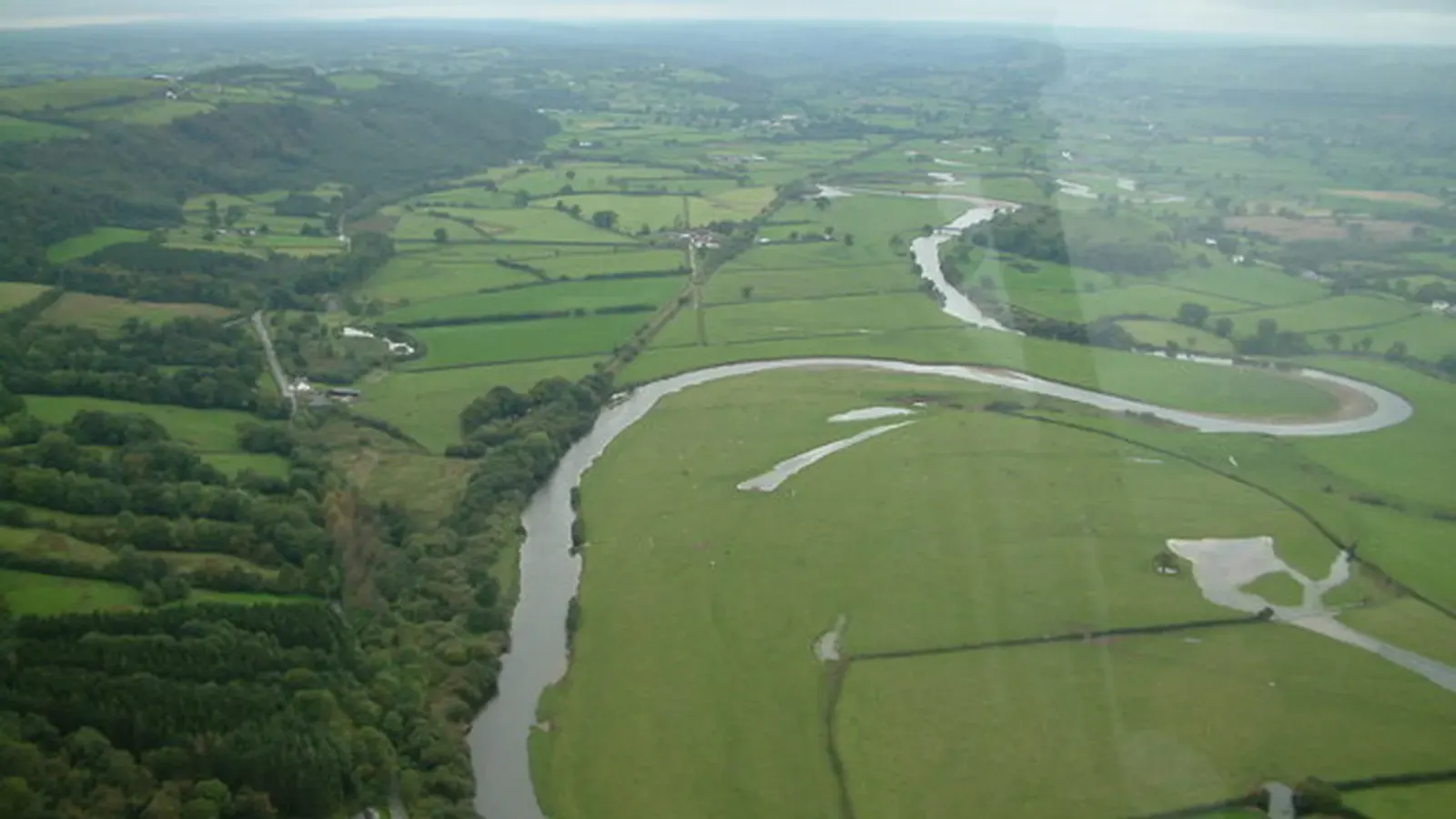
The pattern records a moving system. A single aerial photograph captures one moment in a longer history of erosion and deposition.
A bend changes the distribution of flow
Flow through a curved channel differs across its width and depth. A common pattern is stronger erosion on the outer bank and deposition on the inner side, where a point bar can develop.
The National Park Service uses this contrast to explain lateral migration. It is a useful starting point, although actual flow structure depends on depth, channel geometry, sediment and discharge. The whole bend is not described by one fast arrow on the outside and one slow arrow inside.
Erosion and deposition move the channel
As an outer bank retreats and sediment accumulates elsewhere, the bend can grow or shift downstream. Bank material and vegetation affect how readily the channel changes. Floods can produce especially large adjustments, but ordinary flows can contribute too.
This process transfers material through the floodplain rather than creating a stable border between land and water. A field or path beside a migrating river may occupy ground that was once a channel or will become one later.
A shortcut can bypass a loop
If neighbouring parts of a bend approach closely enough, a new connection can create a shorter route. Water then increasingly follows the shortcut, leaving the former loop less connected to the main channel.
A cutoff can also develop through a chute across part of the floodplain. The exact route depends on the local landscape and flow. Not every abandoned bend is produced by one identical neck-breaking event during a single flood.
The oxbow continues to evolve
Sediment can seal or reduce the old channel's connections, leaving a curved lake or wetland. Further floods may bring water and fine material into it. Vegetation and accumulated sediment can gradually transform the open water into another floodplain habitat.
NPS descriptions of abandoned meanders emphasise this later infilling. An oxbow is a stage in channel history, not evidence that river processes have stopped at that location.
Reading the landscape requires time
Repeated photographs, maps and field measurements reveal changes that one view cannot. Older channels, scroll-like bar patterns and overlapping deposits preserve additional clues.
Researchers interpret those features alongside geology and hydrology. Some bends are constrained by resistant ground or human works, while others migrate more freely. Meandering is therefore not a promise that every river will eventually form the same shapes. It is a set of linked physical processes through which flowing water continually rearranges sediment and channel position.
Explore a related question
How Aquifers Store and Release Groundwater
Sources and further reading
Keep exploring.
One remarkable idea at a time—nature, science, history and beyond.
Last updated October 27, 2026.

Barnakle Editorial Team
Barnakle Editorial Team is the collective byline used for Barnakle’s editorial articles. The contributor profile explains the team identity and links to the publication’s editorial policies.
More from the editorial team →