
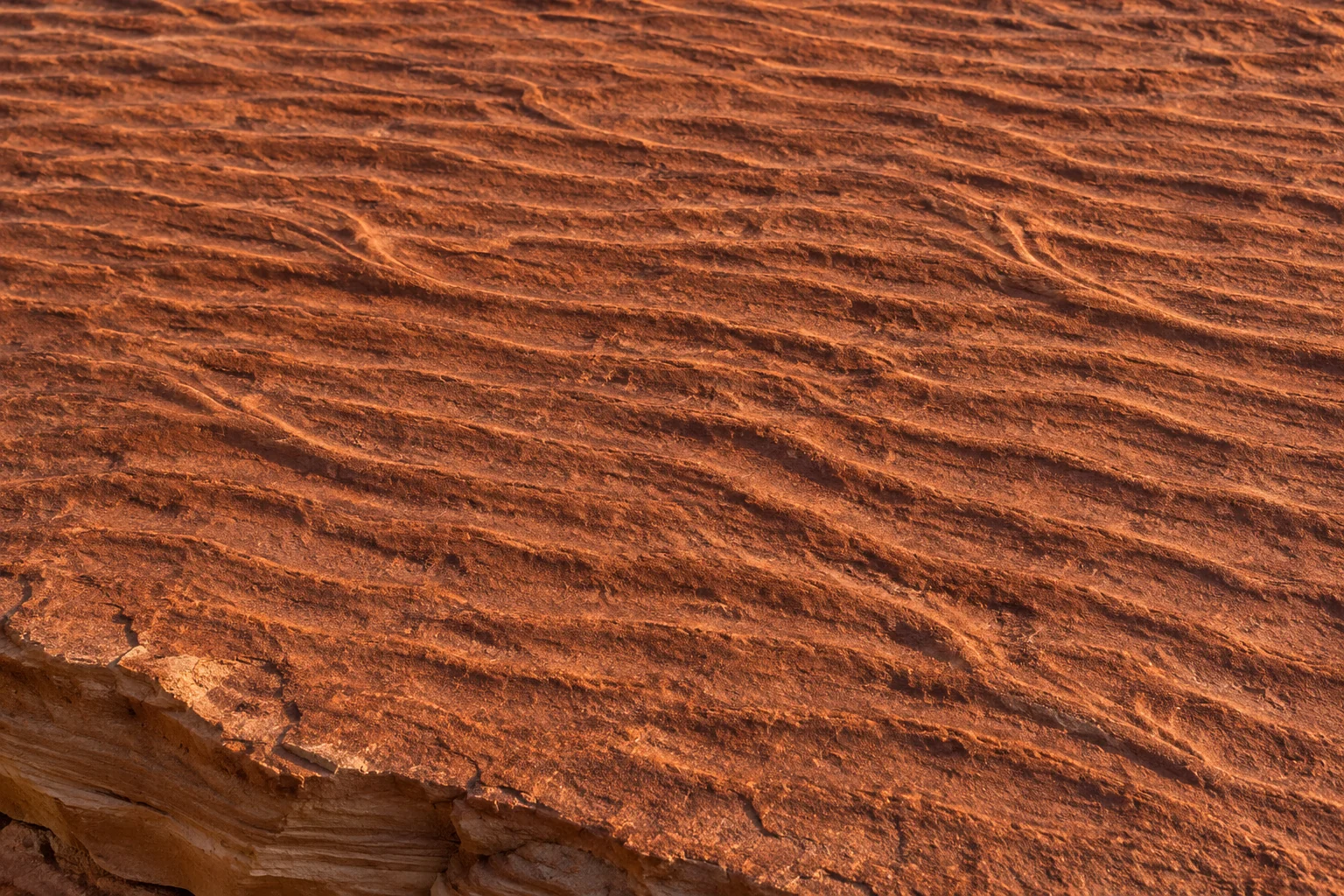
On the stairs at Pipestone National Monument in Minnesota, a few of the quartzite steps have a rippled surface. The waves in the stone were there long before anyone needed a staircase. The National Park Service identifies them as traces of shallow water moving loose sand more than 1.6 billion years ago. A visitor can cross the old riverbed in a few strides. To read it, it helps to turn sideways and look along the shape of a single ridge.[3]
Ripples begin when moving water or wind transports grains across a loose surface. As grains gather in low ridges, the flow over each ridge helps determine where the next grains are picked up and where they settle. If another deposit buries that surface before it is erased, part of the pattern can survive as sediment turns to rock. Geologists use the shape of the ridges, the slopes on either side and the layers inside them to reconstruct the motion that produced them.[1, 2]
A ridge that travels while looking much the same
Imagine a small ridge on a sandy streambed. Water moving steadily in one direction pushes grains up the more gradual slope facing the current. Some pass over the crest and settle on the more sheltered downstream slope. As that repeats, material leaves one side of the ridge and arrives on the other. The whole ripple can migrate downstream while keeping roughly the same shape. It isn’t a solid object being pushed along the bottom. The grains occupying its crest keep changing.[1, 2]
That gives a current ripple its most useful feature. Seen in profile it often has a relatively long, gentle upstream side and a shorter, steeper downstream side. Geologists call them the stoss and lee sides. If several well-preserved ridges have the same asymmetry, the steeper slopes can point toward the direction the current travelled. A drawing that shows only a set of parallel wavy lines misses exactly the information that makes the inference possible.[1, 2]
What changes when the water reverses?
Under waves in shallow water, the bed can experience a back-and-forth sweep. One face of a ripple takes the oncoming flow for part of the cycle. Then the direction reverses and the other face takes its turn. The resulting ridges commonly have more nearly matching slopes. They can record an axis of motion across the crests without giving you a single downstream arrow of the sort you might draw for a river.[1]
Try laying a pencil along the crest in a photograph of wave ripples. Water moved broadly across that pencil, first one way and then the other. From the pencil alone you cannot determine which way the shoreline lay, how salty the water was or whether the basin had a name we would recognize. Waves work sand on lake shores as well as on seacoasts. Recognizing the kind of motion narrows the interpretation. Establishing the setting takes evidence from the surrounding rocks.[1, 3, 4]
A cut edge can preserve what the top has lost
Consider what is happening on the downstream side of a migrating current ripple. Each small addition of sediment lies on a slope. If the bed gradually builds upward while the ripple migrates, part of that inclined deposit can be buried below the next one. A fresh break through the bed may expose a set of thin, slanting layers. These are called cross-laminae. Seen at the right angle, the direction in which they dip can help reveal the direction of the old flow.[1, 2]
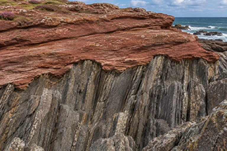
It matters where you make the imaginary cut. A cut across the ridges, parallel to the original flow, can show the gentle climb to a crest and the steep descent beyond it. A cut along the crests can make the same bed look much flatter. The distinction matters in the field because nature doesn’t always supply a convenient viewing surface. An exposed ledge may offer a fine view from above but only a short, oblique section along its edge. Where both faces are visible, a geologist can follow a single crest to the edge and compare its surface profile with the inclined layers directly underneath it.[1, 2]
How a moving bed becomes a solid record
Preservation requires some good timing. One stronger current could plane off the ridges before another layer settles over them. Under different conditions fresh sediment can cover the surface, filling its hollows and shielding the shapes beneath. Over time burial, compaction and cementation can turn the deposits into rock. Later erosion can expose the bed again. The resulting surface captures one stage in a long sequence of changing flows, much as the final footprints on a path survive where earlier ones have been trodden away.[2, 5]
At Chaco Culture National Historical Park, hikers on the South Mesa trail cross ripple marks interpreted as remnants of an ancient seafloor. Park staff used photographs to produce a three-dimensional record of the surface. A flat image can show the arrangement of the crests particularly well in low light. A three-dimensional model also retains their relief and can be examined after the original surface has suffered further wear. The same ridges that once survived burial are now exposed to boots and weather.[5]
Why a mountaintop can carry shallow-water marks
In the Waterton–Glacier area, old layers of the Belt Supergroup preserve ripples, mud cracks and other sedimentary structures. Some of those rocks are now high above the tree line. The marks describe conditions where the sediment accumulated. The modern height records a much later history of the rocks themselves. Put the evidence together and a rock face on a mountain can tell you something about water moving over a bed of loose grains in a long-vanished basin.[4]
On the Minnesota steps, a rounded ridge underfoot might be easy to dismiss as wear. Follow several crests across the surface and compare their spacing and slopes. A pattern emerges that can be compared with those on a streambed today. The extraordinary thing about these marks is how ordinary their cause still is. Water moves a grain over a crest, the grain settles a little farther along, and occasionally enough of those small movements survive to show us which way a river ran.[1, 2, 3]
Related reading
Sources
- European Geosciences Union — Ripple marks in the field
- SUNY Potsdam, Geosciences LibreTexts — Structures formed by unidirectional currents
- National Park Service — Rippled quartzite steps at Pipestone National Monument
- National Park Service — Geology of Glacier National Park and the Belt Supergroup
- National Park Service — Ancient ripple marks on the South Mesa trail at Chaco
Keep exploring.
One remarkable idea at a time—nature, science, history and beyond.
Last updated November 21, 2026.

Barnakle Editorial Team
Barnakle Editorial Team is the collective byline used for Barnakle’s editorial articles. The contributor profile explains the team identity and links to the publication’s editorial policies.
More from the editorial team →